-

Pullars Loch, Ness of Sound, Lerwick
-
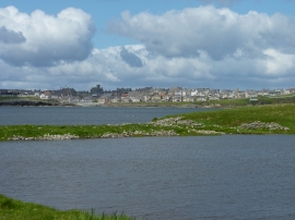
Across the lochan at Skeo Taing, Lerwick
Pullars Loch, Ness of Sound, Lerwick
Across the lochan at Skeo Taing, Lerwick
Location and coordinates are for the approximate centre of Stoura Stane within this administrative area. Geographic features and populated places may cross administrative borders.