Site of 'Dowry Castle', Denshaw
Uploader's Comments
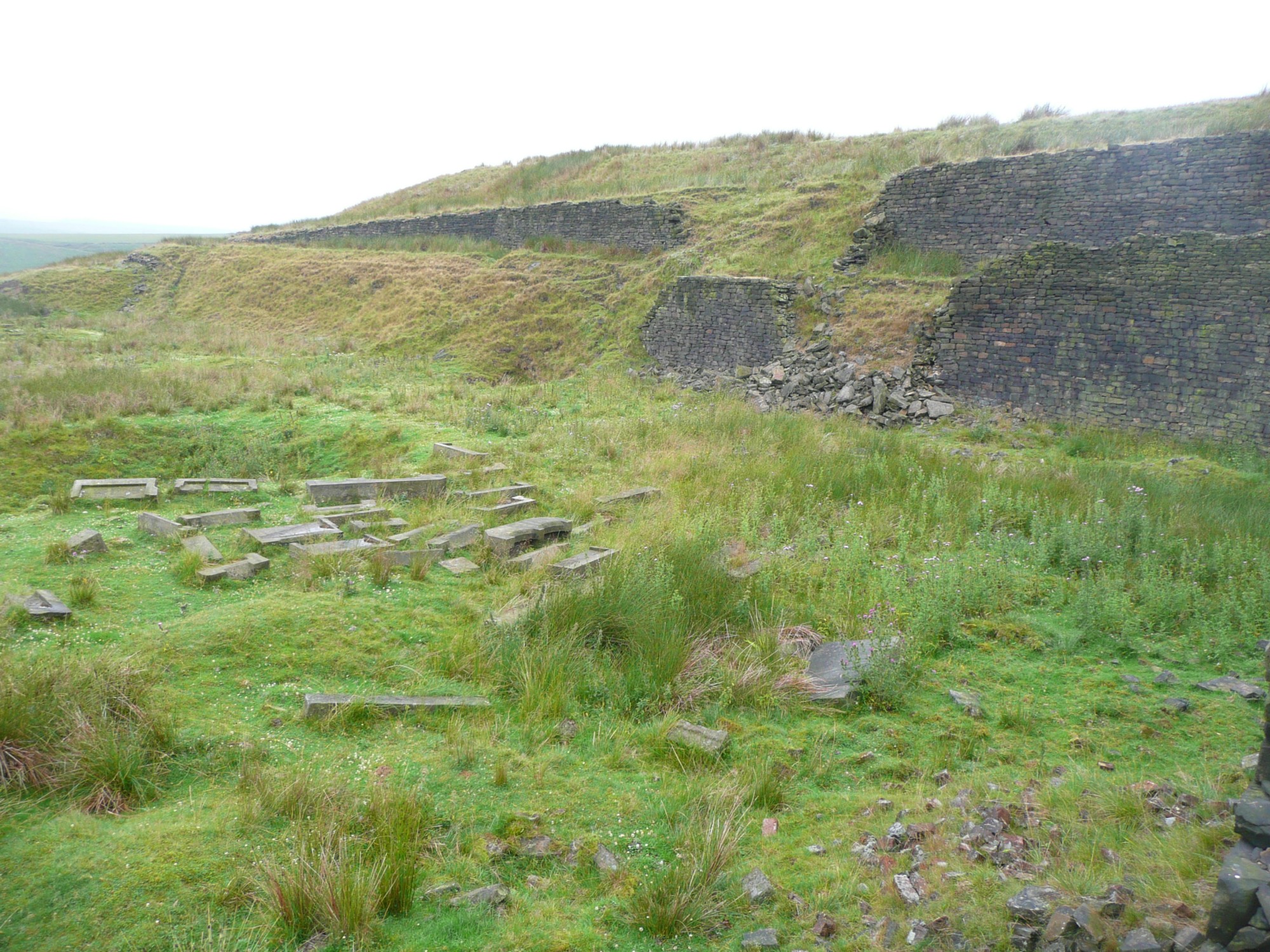
Pieces of unfinished dressed stone suggest a stone-mason's yard, perhaps used when Dowry Reservoir was constructed. However the 1895 OS map shows a building called Dowry Castle here. It was probably demolished soon after, as the reservoir is also shown on that map. The 1850 map shows a farm called Higher Dowry, next to Dowry Road.
Uploaded to Geograph by Humphrey Bolton on 26 July 2010


