Disused weir on the Afon Cynffig, Pyle (2)
Uploader's Comments
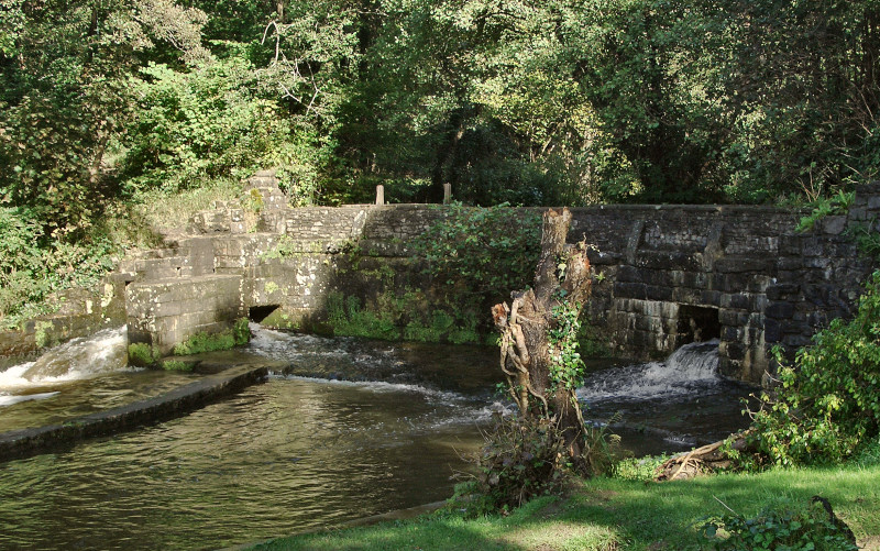
A structure identified as a disused weir on large scale Ordnance Survey mapping, but as a dam in some other sources, and which once played a role in the diversion of river water to Llanmihangel Mill is seen here following substantial rainfall. Water flowing downstream may be seen to pass through here at three separate points. Much passes along a channel (at far left of picture) just beyond the western end of the main wall of the structure, although a considerable amount passes through two openings in the stonework
Uploaded to Geograph by eswales on 6 October 2012


