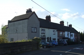
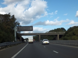
Wood End, Warwickshire

« Gazetteer Entry
Upload Photo

Wood End, Warwickshire

Other current and historical names

  • Edge Hill
  • Parish/Community: Kingsbury
  • District/Borough: North Warwickshire
  • County: Warwickshire
  • Region: West Midlands
  • Category: Populated Place
  • Type: Village
  • Latitude/Longitude: 52°35'1"N 1°39'16"W
  • Eastings/Northings: 423500, 298500
  • OS Grid: SP235985
  • Mapcode Local: GBR 5HC.VYM
  • Mapcode Global: WHCHB.KB91

Location and coordinates are for the approximate centre of Wood End within this administrative area. Geographic features and populated places may cross administrative borders.

BritishPlaceNames.uk is a Good Stuff website.