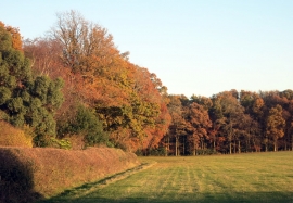
Widefield Wood, Buckinghamshire

« Gazetteer Entry
Upload Photo

Widefield Wood, Buckinghamshire

  • Parish/Community: Medmenham
  • District/Borough: Wycombe
  • County: Buckinghamshire
  • Region: South East
  • Category: Landcover
  • Type: Forest or Wood
  • Latitude/Longitude: 51°33'47"N 0°49'54"W
  • Eastings/Northings: 481072, 185558
  • OS Grid: SU810855
  • Mapcode Local: GBR D5T.SM1
  • Mapcode Global: VHDW9.JZL3

Location and coordinates are for the approximate centre of Widefield Wood within this administrative area. Geographic features and populated places may cross administrative borders.

BritishPlaceNames.uk is a Good Stuff website.