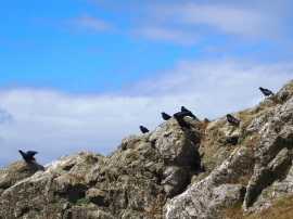
Trwyn Cerrigyreryr, Isle of Anglesey

« Gazetteer Entry
Upload Photo

Trwyn Cerrigyreryr, Isle of Anglesey

  • Parish/Community: Cylch-y-Garn
  • Unitary Authority: Isle of Anglesey
  • Region: Wales
  • Category: Water Feature
  • Type: Island
  • Latitude/Longitude: 53°23'58"N 4°34'32"W
  • Eastings/Northings: 228862, 392273
  • OS Grid: SH288922
  • Mapcode Local: GBR HM2Q.8VV
  • Mapcode Global: WH41X.PTC7

Location and coordinates are for the approximate centre of Trwyn Cerrigyreryr within this administrative area. Geographic features and populated places may cross administrative borders.

BritishPlaceNames.uk is a Good Stuff website.