-
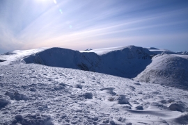
Stob Coire an t-Sneachda and Carn Lochan
-

Walkers on Stob Coire an t-Sneachda from Cairn Gorm
Stob Coire an t-Sneachda and Carn Lochan
Walkers on Stob Coire an t-Sneachda from Cairn Gorm
Location and coordinates are for the approximate centre of Stob Coire an t-Sneachda within this administrative area. Geographic features and populated places may cross administrative borders.