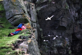
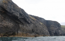
Sloc Dubh an Dùin, Na h-Eileanan Siar

« Gazetteer Entry
Upload Photo

Sloc Dubh an Dùin, Na h-Eileanan Siar

  • Unitary Authority: Na h-Eileanan Siar
  • Region: Scotland
  • Category: Water Feature
  • Type: Bay
  • Latitude/Longitude: 56°48'2"N 7°39'35"W
  • Eastings/Northings: 54661, 781972
  • OS Grid: NL546819
  • Mapcode Local: GBR 7BHR.0D1
  • Mapcode Global: WGV5X.9BRF

Location and coordinates are for the approximate centre of Sloc Dubh an Dùin within this administrative area. Geographic features and populated places may cross administrative borders.

BritishPlaceNames.uk is a Good Stuff website.