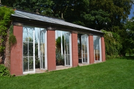
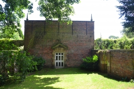
Slip Plantation, Derbyshire

« Gazetteer Entry
Upload Photo

Slip Plantation, Derbyshire

  • Parish/Community: Eckington
  • District/Borough: North East Derbyshire
  • County: Derbyshire
  • Region: East Midlands
  • Category: Landcover
  • Type: Forest or Wood
  • Latitude/Longitude: 53°17'59"N 1°20'43"W
  • Eastings/Northings: 443730, 378315
  • OS Grid: SK437783
  • Mapcode Local: GBR MZ18.JR
  • Mapcode Global: WHDF4.99MZ

Location and coordinates are for the approximate centre of Slip Plantation within this administrative area. Geographic features and populated places may cross administrative borders.

BritishPlaceNames.uk is a Good Stuff website.