-
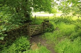
Gate and footpath to Broughton in Furness at Park Head
-

Ruins in Buttstead Wood
Gate and footpath to Broughton in Furness at Park Head
Ruins in Buttstead Wood
Location and coordinates are for the approximate centre of Park Head Wood within this administrative area. Geographic features and populated places may cross administrative borders.