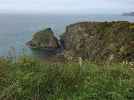
Mynydd Morfa, Pembrokeshire

« Gazetteer Entry
Upload Photo

Mynydd Morfa, Pembrokeshire

  • Parish/Community: Mathry
  • Unitary Authority: Pembrokeshire
  • Region: Wales
  • Category: Geographic Feature
  • Type: Hill or Mountain
  • Latitude/Longitude: 51°57'53"N 5°5'45"W
  • Eastings/Northings: 187413, 234117
  • OS Grid: SM874341
  • Mapcode Local: GBR CD.LBNT
  • Mapcode Global: VH1QK.MWC5

Location and coordinates are for the approximate centre of Mynydd Morfa within this administrative area. Geographic features and populated places may cross administrative borders.

BritishPlaceNames.uk is a Good Stuff website.