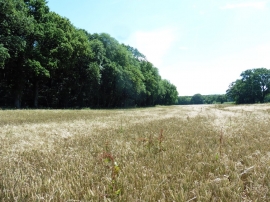
Moulton's Copse, Somerset

« Gazetteer Entry
Upload Photo

Moulton's Copse, Somerset

  • Parish/Community: Hardington Mandeville
  • District/Borough: South Somerset
  • County: Somerset
  • Region: South West
  • Category: Landcover
  • Type: Forest or Wood
  • Latitude/Longitude: 50°53'8"N 2°43'19"W
  • Eastings/Northings: 349296, 109836
  • OS Grid: ST492098
  • Mapcode Local: GBR MK.SG51
  • Mapcode Global: FRA 565R.R98

Location and coordinates are for the approximate centre of Moulton's Copse within this administrative area. Geographic features and populated places may cross administrative borders.

BritishPlaceNames.uk is a Good Stuff website.