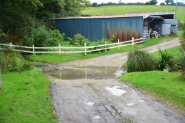
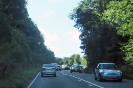
Lower Woodland Plantation, Cornwall

« Gazetteer Entry
Upload Photo

Lower Woodland Plantation, Cornwall

  • Parish/Community: St. Clement
  • Unitary Authority: Cornwall
  • Region: South West
  • Category: Landcover
  • Type: Forest or Wood
  • Latitude/Longitude: 50°17'0"N 5°1'16"W
  • Eastings/Northings: 184870, 46986
  • OS Grid: SW848469
  • Mapcode Local: GBR ZH.6B7Z
  • Mapcode Global: FRA 08C8.X8L

Location and coordinates are for the approximate centre of Lower Woodland Plantation within this administrative area. Geographic features and populated places may cross administrative borders.

BritishPlaceNames.uk is a Good Stuff website.