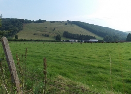
Lower House Wood, Powys

« Gazetteer Entry
Upload Photo

Lower House Wood, Powys

  • Parish/Community: Beguildy
  • Unitary Authority: Powys
  • Region: Wales
  • Category: Landcover
  • Type: Forest or Wood
  • Latitude/Longitude: 52°21'30"N 3°7'3"W
  • Eastings/Northings: 323978, 273968
  • OS Grid: SO239739
  • Mapcode Local: GBR B1.SH30
  • Mapcode Global: VH68Z.XZ4C

Location and coordinates are for the approximate centre of Lower House Wood within this administrative area. Geographic features and populated places may cross administrative borders.

BritishPlaceNames.uk is a Good Stuff website.