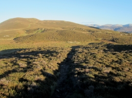
Low Moss, Cumbria

« Gazetteer Entry
Upload Photo

Low Moss, Cumbria

  • Built-Up Area: Braithwaite
  • Parish/Community: Above Derwent
  • District/Borough: Allerdale
  • County: Cumbria
  • Region: North West
  • Category: Landcover
  • Type: Other Landcover
  • Latitude/Longitude: 54°35'8"N 3°12'45"W
  • Eastings/Northings: 321737, 521854
  • OS Grid: NY217218
  • Mapcode Local: GBR 6H0D.9W
  • Mapcode Global: WH705.MZFV

Location and coordinates are for the approximate centre of Low Moss within this administrative area. Geographic features and populated places may cross administrative borders.

BritishPlaceNames.uk is a Good Stuff website.