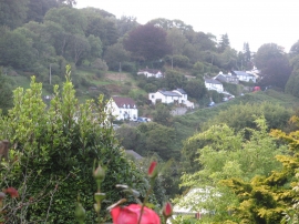
Lee Hills, Devon

« Gazetteer Entry
Upload Photo

Lee Hills, Devon

  • Built-Up Area: Berrynarbor
  • Parish/Community: Berrynarbor
  • District/Borough: North Devon
  • County: Devon
  • Region: South West
  • Category: Geographic Feature
  • Type: Hill or Mountain
  • Latitude/Longitude: 51°11'57"N 4°4'10"W
  • Eastings/Northings: 255500, 146500
  • OS Grid: SS555465
  • Mapcode Local: GBR KQ.4NW1
  • Mapcode Global: VH4MC.D3YW

Location and coordinates are for the approximate centre of Lee Hills within this administrative area. Geographic features and populated places may cross administrative borders.

BritishPlaceNames.uk is a Good Stuff website.