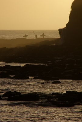
Hobarrow Bay, Dorset

« Gazetteer Entry
Upload Photo

Hobarrow Bay, Dorset

  • Parish/Community: Kimmeridge
  • District/Borough: Purbeck
  • County: Dorset
  • Region: South West
  • Category: Water Feature
  • Type: Other Water Feature
  • Latitude/Longitude: 50°36'22"N 2°8'59"W
  • Eastings/Northings: 389500, 78500
  • OS Grid: SY895785
  • Mapcode Local: GBR 22D.WWV
  • Mapcode Global: FRA 67DG.LB1

Location and coordinates are for the approximate centre of Hobarrow Bay within this administrative area. Geographic features and populated places may cross administrative borders.

BritishPlaceNames.uk is a Good Stuff website.