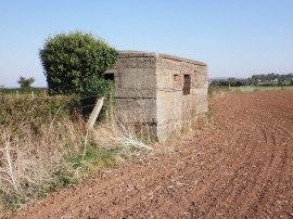
Gristclose Coppice, Somerset

« Gazetteer Entry
Upload Photo

Gristclose Coppice, Somerset

  • Parish/Community: Carhampton
  • District/Borough: West Somerset
  • County: Somerset
  • Region: South West
  • Category: Landcover
  • Type: Forest or Wood
  • Latitude/Longitude: 51°10'54"N 3°25'2"W
  • Eastings/Northings: 301036, 143464
  • OS Grid: ST010434
  • Mapcode Local: GBR LM.5S2T
  • Mapcode Global: VH6GM.QK8D

Location and coordinates are for the approximate centre of Gristclose Coppice within this administrative area. Geographic features and populated places may cross administrative borders.

BritishPlaceNames.uk is a Good Stuff website.