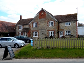
Grange Copse, Dorset

« Gazetteer Entry
Upload Photo

Grange Copse, Dorset

  • Parish/Community: Pulham
  • District/Borough: North Dorset
  • County: Dorset
  • Region: South West
  • Category: Landcover
  • Type: Forest or Wood
  • Latitude/Longitude: 50°52'57"N 2°24'10"W
  • Eastings/Northings: 371751, 109312
  • OS Grid: ST717093
  • Mapcode Local: GBR MZ.SR0Q
  • Mapcode Global: FRA 56VR.X9T

Location and coordinates are for the approximate centre of Grange Copse within this administrative area. Geographic features and populated places may cross administrative borders.

BritishPlaceNames.uk is a Good Stuff website.