-

City of Carlisle : The M6 Motorway
-
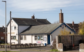
The Arroyo Arms, Edgehill Road, Carlisle - March 2017 (2)
City of Carlisle : The M6 Motorway
The Arroyo Arms, Edgehill Road, Carlisle - March 2017 (2)
Location and coordinates are for the approximate centre of Garlands within this administrative area. Geographic features and populated places may cross administrative borders.