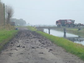
Flag Fen, Cambridgeshire

« Gazetteer Entry
Upload Photo

Flag Fen, Cambridgeshire

  • Parish/Community: Whittlesey
  • District/Borough: Fenland
  • County: Cambridgeshire
  • Region: Eastern
  • Category: Landcover
  • Type: Other Landcover
  • Latitude/Longitude: 52°32'5"N 0°6'17"W
  • Eastings/Northings: 528644, 294679
  • OS Grid: TL286946
  • Mapcode Local: GBR K1S.494
  • Mapcode Global: VHGKZ.4KF5

Location and coordinates are for the approximate centre of Flag Fen within this administrative area. Geographic features and populated places may cross administrative borders.

BritishPlaceNames.uk is a Good Stuff website.