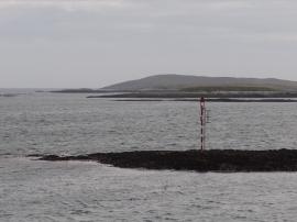
Eilean a' Charnain, Na h-Eileanan Siar

« Gazetteer Entry
Upload Photo

Eilean a' Charnain, Na h-Eileanan Siar

  • Unitary Authority: Na h-Eileanan Siar
  • Region: Scotland
  • Category: Water Feature
  • Type: Island
  • Latitude/Longitude: 57°40'36"N 7°4'33"W
  • Eastings/Northings: 97530, 876562
  • OS Grid: NF975765
  • Mapcode Local: GBR 88XF.HRW
  • Mapcode Global: WGW32.89RN

Location and coordinates are for the approximate centre of Eilean a' Charnain within this administrative area. Geographic features and populated places may cross administrative borders.

BritishPlaceNames.uk is a Good Stuff website.