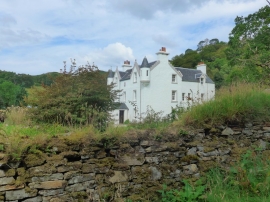
Dail an Leigh, Highland

« Gazetteer Entry
Upload Photo

Dail an Leigh, Highland

  • Unitary Authority: Highland
  • Region: Scotland
  • Category: Populated Place
  • Type: Other Settlement
  • Latitude/Longitude: 56°45'36"N 5°42'31"W
  • Eastings/Northings: 173408, 769320
  • OS Grid: NM734693
  • Mapcode Local: GBR DB8V.KVX
  • Mapcode Global: WH0DQ.8BSW

Location and coordinates are for the approximate centre of Dail an Leigh within this administrative area. Geographic features and populated places may cross administrative borders.

BritishPlaceNames.uk is a Good Stuff website.