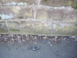
Crowton, Cheshire West and Chester

« Gazetteer Entry
Upload Photo

Crowton, Cheshire West and Chester

Other current and historical names

  • Cooksongreen
  • Parish/Community: Crowton
  • Unitary Authority: Cheshire West and Chester
  • Region: North West
  • Category: Populated Place
  • Type: Village
  • Latitude/Longitude: 53°15'59"N 2°38'1"W
  • Eastings/Northings: 357833, 374591
  • OS Grid: SJ578745
  • Mapcode Local: GBR BZ1N.MQ
  • Mapcode Global: WH999.J522

Location and coordinates are for the approximate centre of Crowton within this administrative area. Geographic features and populated places may cross administrative borders.

BritishPlaceNames.uk is a Good Stuff website.