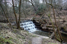
Crownpoint Wood, Staffordshire

« Gazetteer Entry
Upload Photo

Crownpoint Wood, Staffordshire

  • Parish/Community: Cheddleton
  • District/Borough: Staffordshire Moorlands
  • County: Staffordshire
  • Region: West Midlands
  • Category: Landcover
  • Type: Forest or Wood
  • Latitude/Longitude: 53°4'12"N 2°3'47"W
  • Eastings/Northings: 395866, 352540
  • OS Grid: SJ958525
  • Mapcode Local: GBR 251.F7C
  • Mapcode Global: WHBCP.83S7

Location and coordinates are for the approximate centre of Crownpoint Wood within this administrative area. Geographic features and populated places may cross administrative borders.

BritishPlaceNames.uk is a Good Stuff website.