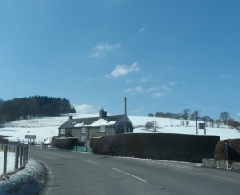
Coed Glanllyn, Gwynedd

« Gazetteer Entry
Upload Photo

Coed Glanllyn, Gwynedd

  • Parish/Community: Llanuwchllyn
  • Unitary Authority: Gwynedd
  • Region: Wales
  • Category: Landcover
  • Type: Forest or Wood
  • Latitude/Longitude: 52°52'26"N 3°39'28"W
  • Eastings/Northings: 288506, 332006
  • OS Grid: SH885320
  • Mapcode Local: GBR 69.QZXB
  • Mapcode Global: WH67B.S184

Location and coordinates are for the approximate centre of Coed Glanllyn within this administrative area. Geographic features and populated places may cross administrative borders.

BritishPlaceNames.uk is a Good Stuff website.