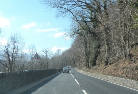
Coed Ffordd y Bala, Gwynedd

« Gazetteer Entry
Upload Photo

Coed Ffordd y Bala, Gwynedd

  • Parish/Community: Dolgellau
  • Unitary Authority: Gwynedd
  • Region: Wales
  • Category: Landcover
  • Type: Forest or Wood
  • Latitude/Longitude: 52°45'18"N 3°51'8"W
  • Eastings/Northings: 275078, 319102
  • OS Grid: SH750191
  • Mapcode Local: GBR 62.ZDNB
  • Mapcode Global: WH56P.S0PP

Location and coordinates are for the approximate centre of Coed Ffordd y Bala within this administrative area. Geographic features and populated places may cross administrative borders.

BritishPlaceNames.uk is a Good Stuff website.