-

Llwybr Allt Caeau Bychan Mawr Footpath
-
Ruin in Talylan Forest
Llwybr Allt Caeau Bychan Mawr Footpath
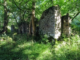
Ruin in Talylan Forest
Location and coordinates are for the approximate centre of Coed Duon within this administrative area. Geographic features and populated places may cross administrative borders.