-
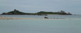
Northwethel
-

Northwethel-an uninhabited island near Old Grimsby-Tresco
Northwethel
Northwethel-an uninhabited island near Old Grimsby-Tresco
Location and coordinates are for the approximate centre of Coal Ledge within this administrative area. Geographic features and populated places may cross administrative borders.