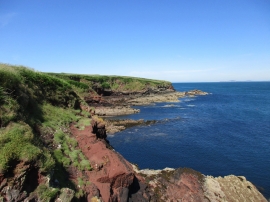
Castle Head, Pembrokeshire

« Gazetteer Entry
Upload Photo

Castle Head, Pembrokeshire

  • Parish/Community: Marloes and St. Brides
  • Unitary Authority: Pembrokeshire
  • Region: Wales
  • Category: Geographic Feature
  • Type: Coastal Headland
  • Latitude/Longitude: 51°45'20"N 5°11'31"W
  • Eastings/Northings: 179788, 211158
  • OS Grid: SM797111
  • Mapcode Local: GBR G2.XDF3
  • Mapcode Global: VH0V6.Y4HD

Location and coordinates are for the approximate centre of Castle Head within this administrative area. Geographic features and populated places may cross administrative borders.

BritishPlaceNames.uk is a Good Stuff website.