-
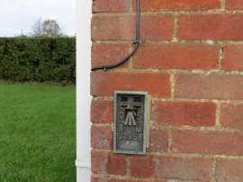
Ordnance Survey Flush Bracket G2959
-

Track from Sparham Hall Farm joining Dunham Road
Ordnance Survey Flush Bracket G2959
Track from Sparham Hall Farm joining Dunham Road
Location and coordinates are for the approximate centre of Buscall's Plantation within this administrative area. Geographic features and populated places may cross administrative borders.