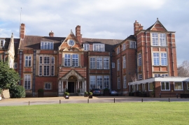
Buckfield Copse, Hampshire

« Gazetteer Entry
Upload Photo

Buckfield Copse, Hampshire

  • Parish/Community: Sherfield on Loddon
  • District/Borough: Basingstoke and Deane
  • County: Hampshire
  • Region: South East
  • Category: Landcover
  • Type: Forest or Wood
  • Latitude/Longitude: 51°18'23"N 1°1'31"W
  • Eastings/Northings: 468035, 156833
  • OS Grid: SU680568
  • Mapcode Local: GBR B65.5JK
  • Mapcode Global: VHDXK.5FR6

Location and coordinates are for the approximate centre of Buckfield Copse within this administrative area. Geographic features and populated places may cross administrative borders.

BritishPlaceNames.uk is a Good Stuff website.