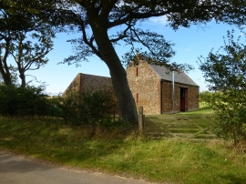
Bluestone Farm Plantation, Norfolk

« Gazetteer Entry
Upload Photo

Bluestone Farm Plantation, Norfolk

  • Parish/Community: Ringstead
  • District/Borough: King's Lynn and West Norfolk
  • County: Norfolk
  • Region: Eastern
  • Category: Landcover
  • Type: Forest or Wood
  • Latitude/Longitude: 52°56'20"N 0°33'30"E
  • Eastings/Northings: 572026, 341023
  • OS Grid: TF720410
  • Mapcode Local: GBR P2Y.Q0W
  • Mapcode Global: WHKPG.KD47

Location and coordinates are for the approximate centre of Bluestone Farm Plantation within this administrative area. Geographic features and populated places may cross administrative borders.

BritishPlaceNames.uk is a Good Stuff website.