-
The mast plate and the engine block
-

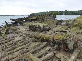
An old hulk
The mast plate and the engine block
An old hulk
Location and coordinates are for the approximate centre of Black Mixen within this administrative area. Geographic features and populated places may cross administrative borders.