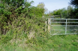
Axletree Plantation, East Sussex

« Gazetteer Entry
Upload Photo

Axletree Plantation, East Sussex

  • Parish/Community: Peasmarsh
  • District/Borough: Rother
  • County: East Sussex
  • Region: South East
  • Category: Landcover
  • Type: Forest or Wood
  • Latitude/Longitude: 50°57'42"N 0°40'10"E
  • Eastings/Northings: 587573, 121428
  • OS Grid: TQ875214
  • Mapcode Local: GBR QXF.N4M
  • Mapcode Global: FRA D69K.LQM

Location and coordinates are for the approximate centre of Axletree Plantation within this administrative area. Geographic features and populated places may cross administrative borders.

BritishPlaceNames.uk is a Good Stuff website.