-

High tide at Kilvickeon Beach, Isle of Mull
-
Looking east from Garbh Eilean
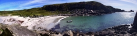
High tide at Kilvickeon Beach, Isle of Mull
Looking east from Garbh Eilean
Location and coordinates are for the approximate centre of A' Chlèit within this administrative area. Geographic features and populated places may cross administrative borders.